
NWS downgrades weekend rainfall totals
The National Weather Service is forecasting that the multiple rounds of rain which started on Thursday afternoon in Clay County and much of west central Indiana will become heavier over the weekend and could last through Tuesday.
Updated weather radar now indicates that Clay County is expected to get from three to four inches in the northern three-fourths and two to three inches in the southern region.
Those numbers are down from original forecasts of six to eight inches.
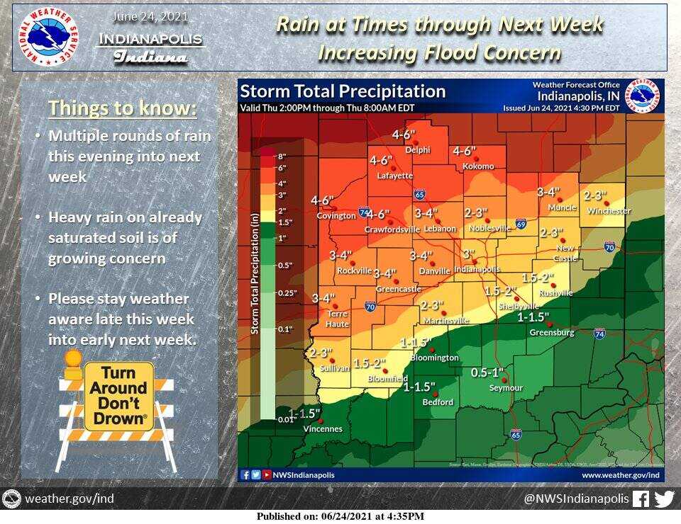
Given the expected amounts and recent flooding that has left soil saturated, there is growing concern of repeat flooding in central and southern Indiana. Heaviest amounts of rain are aiming toward eastern Illinois and western Indiana, which would particularly affect the Wabash River basin.
Drivers are reminded to not drive through standing water.
Please stay weather aware over the weekend and early next week.