
TOP TORY OF THE DAY: Do you know about the Coal Mine Information System?
The Coal Mine Information System (CMIS) is a repository for historical coal mining information in Indiana.
It was developed through a cooperative agreement between the Indiana Geological Survey and the Indiana Department of Natural Resources, Division of Reclamation. In addition to historical documents, prepared maps and reports, the CMIS has compiled digital geographic data and associated mine information. This data is publicly accessible through an online map viewer.
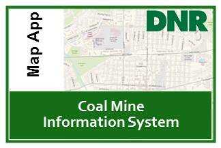
CMIS Map Viewer
The CMIS web map has moved. It is now an ArcGIS Online map application and will be administered by the Indiana Department of Natural Resources. This map shows the location of all documented surface and underground coal mines in the state.
It can be accessed at dnrmaps.dnr.in.gov/apps/cmis.htm or by selecting the thumbnail below. Please contact cmishelp@dnr.IN.gov if you have questions or need assistance.
About the CMIS Data

The data provided by the Indiana Division of Reclamation on this Coal Mine Information System (CMIS) is intended for informational and planning purposes only.
CMIS is a public resource of general information. The Indiana Division of Reclamation makes no warranty as to the content, sequence, accuracy, or completeness of any of the current or abandoned mine data provided.
This map has been created using the best available information at the time of its creation and is believed to be representative but accuracy is not guaranteed.
The information contained in GIS data used to generate the CMIS map is NOT to be construed or used as a “legal description” or placement when used in conjunction with aerial photography. Translation error inherent in shapefiles, coordinate systems, GPS equipment, and base maps limits the accuracy of the information within this map and as such only the paper maps that are stamped, signed by an engineer, and approved by the Division of Reclamation are to be considered official legal copies.
For more information and suggested corrections to our CMIS map please contact Elee1@dnr.IN.gov.
For more information regarding the official maps please contact our offices at 812-665-2207.